


このアプリのYoutube動画がある場合はURLを送信してください。詳細 »
APPLICATION INFO - iPhoneアプリの詳細情報
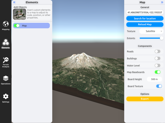
3D Mappa revolutionizes GIS on mobile. Our app puts powerful terrain analysis tools in the palm of your hand, making complex tasks effortless. Instantly visualize elevation, slope, contours, and more. Simplify workflows with intuitive features designed for speed and efficiency. Export data in seconds to industry-standard formats like DXF, SHP, CSV, OBJ, glTIF, and STL, ensuring compatibility with AutoCAD, and GIS software. Say goodbye to cumbersome processes and hello to streamlined GIS on mobile.
Key features:
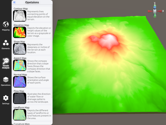
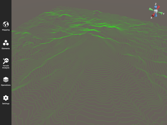
- Contour Map: Represents lines connecting points of equal elevation on the terrain.
- Elevation Map: Depicts the elevation or height values of the terrain as a grayscale or color image.
- Slope Map: Represents the steepness or incline of the terrain at each location.
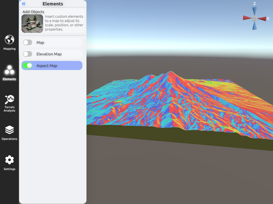
- Aspect Map: Shows the compass direction that a slope faces.
- Normal Map: Shows the surface orientation and angle of each point.
- Flow Map: Illustrates the direction of water flow or drainage patterns across the landscape.
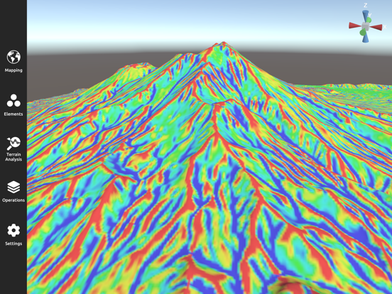
- Landform Map: Depicts the different types of landforms or land features present in the area.
- Curvature Map: Indicates the amount and direction of curvature of the terrain.
- Residual Map: Highlights variations or deviations from a baseline, often used in geological analysis.
Terms of Use: https://www.apple.com/legal/internet-services/itunes/dev/stdeula/
Key features:
- Contour Map: Represents lines connecting points of equal elevation on the terrain.
- Elevation Map: Depicts the elevation or height values of the terrain as a grayscale or color image.
- Slope Map: Represents the steepness or incline of the terrain at each location.
- Aspect Map: Shows the compass direction that a slope faces.
- Normal Map: Shows the surface orientation and angle of each point.
- Flow Map: Illustrates the direction of water flow or drainage patterns across the landscape.
- Landform Map: Depicts the different types of landforms or land features present in the area.
- Curvature Map: Indicates the amount and direction of curvature of the terrain.
- Residual Map: Highlights variations or deviations from a baseline, often used in geological analysis.
Terms of Use: https://www.apple.com/legal/internet-services/itunes/dev/stdeula/
 このアプリはiPhone、iPadの両方に対応しています。
カテゴリー
ナビゲーション
ナビゲーション
リリース
2024/4/11
2024/4/11
バージョン
1.0
1.0
言語
サイズ
138.8 MB
138.8 MB
条件
スクリーンショット - iPhone | iPad
スクリーンショット - iPhone | iPad
Andres Narvaez の他のアプリ » もっと見る
» 目的別iPhoneアプリ検索
- 辞書 » 日本語対応の辞書 » 英和辞典
- 学習 » 英単語 » 英会話 » クイズで楽しく
- スケジュール » 管理 » Googleカレンダー


CatchApp新着アプリレビュー
 日本縦断てつどうの旅」")
様々な楽しみ方で運転士として成長していく鉄道運転士育成RPG「プラチナ・トレイン(プラトレ) 日本縦断てつどうの旅」
2016-05-17 00:00

日本語にはない英語発音のリスニングを楽しく学べる「発音どっち?英語リスニング 」
2014-12-20 12:00

指先の瞬発力が試されるカジュアルゲーム「早撃ちパニック」をリリース!
2014-12-08 15:21
新着アプリ動画
-
 ¥1500
¥1500

-
 ¥600
¥600
-
 ¥3000
¥3000