


このアプリのYoutube動画がある場合はURLを送信してください。詳細 »
APPLICATION INFO - iPhoneアプリの詳細情報
GPX viewer 2 is the brand new version of my first GPX viewer app! With new features, a new modern user interface and new interactions. I've listened to your needs and built a new app just for you!
Import your tracks from GPX files (tracks or routes) into the app. Even if your file contains many tracks.
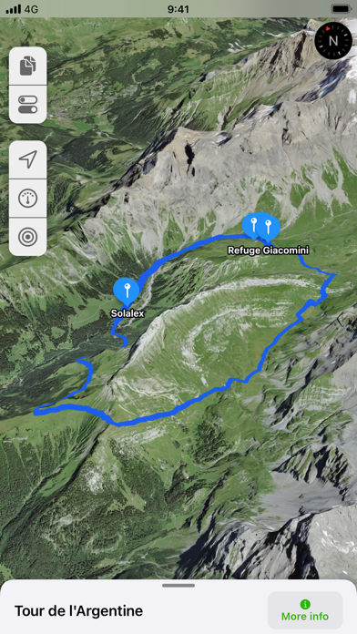
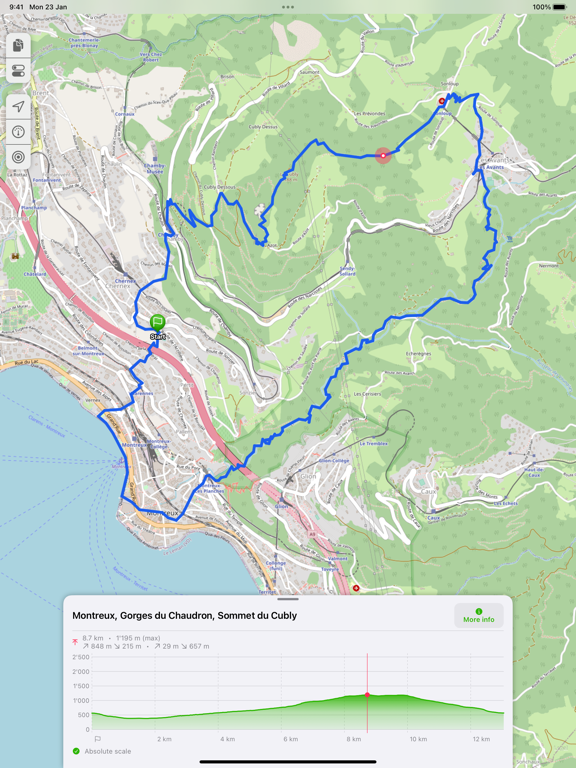
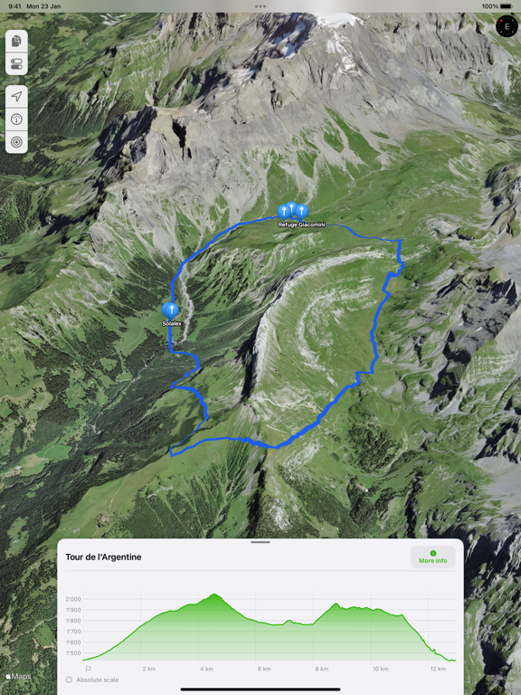
Display their tracks on different preset base maps (plan, satellite, OpenStreetMap, OpenTopoMap, Swisstopo, IGN) or on any of your own custom base maps.
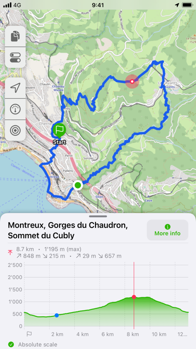
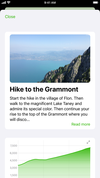
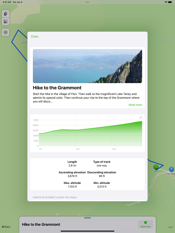
Display an interactive elevation profile to evaluate track difficulty. And check out all of information contained into your GPX file (such as description, images, links, waypoints and stats).
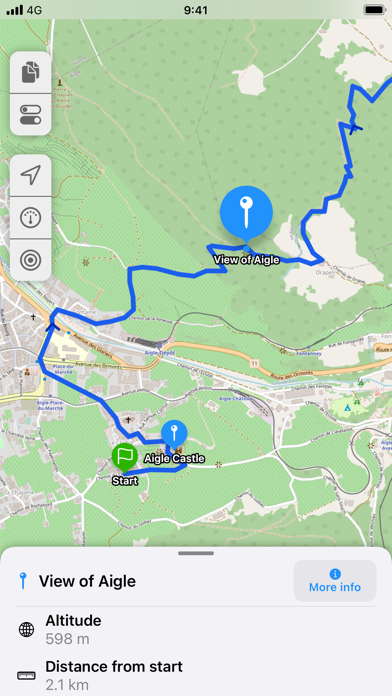
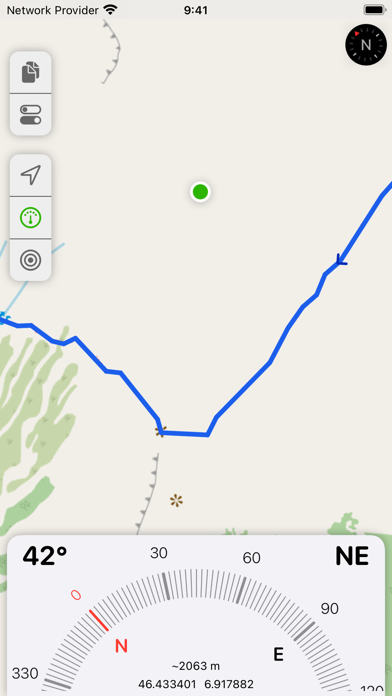
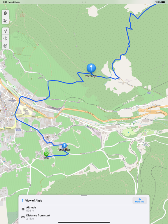
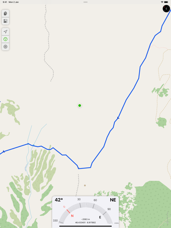
Track your position along the route during your hike by following the path on the interactive map. You can also view GPX points of interest, navigation tools (compass, GPS location, altitude) and a speedometer. The app even provides weather conditions at the starting point of your itinerary.
All what you need to go hiking and follow your route... without ads! The only in-app purchases are tips for few other features, just take a look.
GPX viewer is the app you need for your hikes and bike or motorcycle trips!
Features details:
- Import of GPX files via file, web link or from your Fitness app
- Management of imported GPX (library)
- Display GPX track on the map (track and route, also support multi-tracks)
- Several base maps: map, hybrid, satellite 3D, OpenStreetMap, OpenTopoMap, Swisstopo
- Possibility to set your own custom maps from a library or manually
- Possibility to download maps for offline use
- Displayed on the map: current position, start and end of the route, points of interest along the route, scale, route direction
- Choice of color and size of the route
- Locking of screen standby to better follow the route
- Map cache system
- Display of GPX details: name, description, elevation profile, elevation differences, distance, altitudes, image gallery, link, points of interest
- Display details of a point of interest: name, description, image gallery, links, distance on the track
- Navigation tools: compass, GPS location, altitude
- Weather condition at starting point
- Access to the route via Maps, Google Maps or Waze
- Sharing a GPX
- GPX editor
- Speedometer
Note: Hey! If you can't open a file from my app, please contact me and provide me the file, I will take a look.
What about GPX viewer 1? The app is still available on the App Store if your device is not compatible with GPX viewer 2.
Import your tracks from GPX files (tracks or routes) into the app. Even if your file contains many tracks.
Display their tracks on different preset base maps (plan, satellite, OpenStreetMap, OpenTopoMap, Swisstopo, IGN) or on any of your own custom base maps.
Display an interactive elevation profile to evaluate track difficulty. And check out all of information contained into your GPX file (such as description, images, links, waypoints and stats).
Track your position along the route during your hike by following the path on the interactive map. You can also view GPX points of interest, navigation tools (compass, GPS location, altitude) and a speedometer. The app even provides weather conditions at the starting point of your itinerary.
All what you need to go hiking and follow your route... without ads! The only in-app purchases are tips for few other features, just take a look.
GPX viewer is the app you need for your hikes and bike or motorcycle trips!
Features details:
- Import of GPX files via file, web link or from your Fitness app
- Management of imported GPX (library)
- Display GPX track on the map (track and route, also support multi-tracks)
- Several base maps: map, hybrid, satellite 3D, OpenStreetMap, OpenTopoMap, Swisstopo
- Possibility to set your own custom maps from a library or manually
- Possibility to download maps for offline use
- Displayed on the map: current position, start and end of the route, points of interest along the route, scale, route direction
- Choice of color and size of the route
- Locking of screen standby to better follow the route
- Map cache system
- Display of GPX details: name, description, elevation profile, elevation differences, distance, altitudes, image gallery, link, points of interest
- Display details of a point of interest: name, description, image gallery, links, distance on the track
- Navigation tools: compass, GPS location, altitude
- Weather condition at starting point
- Access to the route via Maps, Google Maps or Waze
- Sharing a GPX
- GPX editor
- Speedometer
Note: Hey! If you can't open a file from my app, please contact me and provide me the file, I will take a look.
What about GPX viewer 1? The app is still available on the App Store if your device is not compatible with GPX viewer 2.
 このアプリはiPhone、iPadの両方に対応しています。
カテゴリー
ナビゲーション
ナビゲーション
リリース
2023/1/4
2023/1/4
更新
2023/4/20
2023/4/20
バージョン
2.0.5
2.0.5
言語
サイズ
3.8 MB
3.8 MB
条件
このバージョンの新機能
- NEW: You can know import any GPX files from your workouts (from Fitness app)
- Fix an issue with offline maps when base map URL template was too long (like IGN maps)
- NEW: You can know import any GPX files from your workouts (from Fitness app)
- Fix an issue with offline maps when base map URL template was too long (like IGN maps)
スクリーンショット - iPhone | iPad
スクリーンショット - iPhone | iPad
Jonathan Gander の他のアプリ » もっと見る
» 目的別iPhoneアプリ検索
- 辞書 » 日本語対応の辞書 » 英和辞典
- 学習 » 英単語 » 英会話 » クイズで楽しく
- スケジュール » 管理 » Googleカレンダー


CatchApp新着アプリレビュー
 日本縦断てつどうの旅」")
様々な楽しみ方で運転士として成長していく鉄道運転士育成RPG「プラチナ・トレイン(プラトレ) 日本縦断てつどうの旅」
2016-05-17 00:00

日本語にはない英語発音のリスニングを楽しく学べる「発音どっち?英語リスニング 」
2014-12-20 12:00

指先の瞬発力が試されるカジュアルゲーム「早撃ちパニック」をリリース!
2014-12-08 15:21
新着アプリ動画
-
 ¥1500
¥1500

-
 ¥600
¥600
-
 ¥3000
¥3000